Creating Diagrams — Auto-Insert Borders
To insert geographic borders into diagrams, select Insert >> Auto-Insert >> Borders from the main menu.
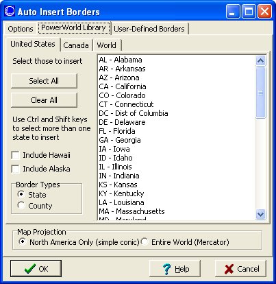
Auto Insert Borders Dialog
The PowerWorld border library includes borders for the entire world, as well as Canadian Provinces and state and county borders for the United States.
-
Select multiple borders by holding down the Shift or Ctrl keys while making your selection.
-
Choose from simple conic, or Mercator map projections
-
Use the options tab to specify line color, line thickness, fill color, stack level and layer
-
You can also create and use your own User-Defined Border files
See the FAQ or Simulator Help for additional information on inserting and using borders.
Next Tip: Auto-Insert Buses/Substations
Tags: How-to,Simulator,Tip,Tutorial
July 3, 2012

